
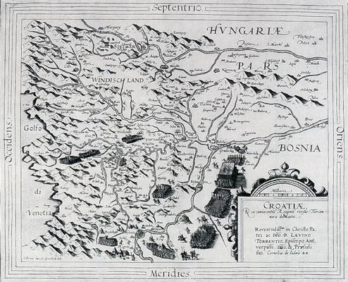
Map of Croatia
|
Antwerp Gerhard de Jode, Cornelis de Jode 1593 Paper, engraving 40.5 x 32.6 cm Scale: cca 1:800.000 The map shows the area of Croatia at the end of the 16th century, at the time of the battle at Sisak. The author's signature is in the bottom left corner: Formis haeredu(m) Gerardi de Jode. Bought at the 'Taussig & Taussig' second-hand bookstore in Prague in 1913. A. Pandzic, Pet stoljeca zemljopisnih karata Hrvatske, Zagreb, 1988, page 68, catalogue number 5 |
|
HPM/PMH-003818 |


 |